Geographic coordinates feel abstract until you need them to answer a simple question, what time is it there, right now, in that exact place. A city page is easy. A coastline village, a mountain pass, a research station, a ship offshore, that is where coordinates and local reference points become the backbone of reliable time, location, and context.
Geographic coordinates tell you where, local reference points tell you what that place means to people and systems. Latitude and longitude locate a point on Earth, while datums, projections, and named landmarks keep that point consistent across maps and devices. Once location is stable, time becomes stable, time zones, daylight rules, and sunrise patterns can be applied with confidence. Accurate coordinates plus clear reference points are the clean path to trustworthy global time.
Mini quiz to test your location and time intuition
What geographic coordinates really represent
Coordinates are a language for location. The most common form is latitude and longitude in degrees. Latitude tells you how far north or south a point sits relative to the equator. Longitude tells you how far east or west it sits relative to a prime reference line. Put the pair together and you get a single point that can be used by maps, phones, satellites, shipping systems, and time tools.
When Time.you shows the current time for a city, it is leaning on location data under the hood, even if you never see it. The moment you move beyond a city name, you need the coordinate layer to stay accurate. That matters for remote areas, islands, border towns, and places with the same name in different countries.
Think of Earth as a grid you can wrap around a globe. Latitude lines run sideways, longitude lines run top to bottom. A coordinate pair points to one crossing on that grid.
Local reference points keep coordinates human
A coordinate is precise, but it is not always meaningful on its own. People navigate with reference points. A river mouth. A central station. A bay. A mountain ridge. A city hall. A harbor entrance. These local anchors help confirm that a coordinate makes sense, and they help you communicate location without asking someone to read numbers out loud.
Reference points also protect you from common confusion. Many places share names. Many towns sprawl across multiple time rule boundaries. Some regions use the same time zone name but follow different daylight rules across borders. That is why Time.you benefits from pairing raw coordinates with clearly labeled local context, from neighborhoods in Singapore to airports near Dubai and coastlines near Lima.
Latitude and longitude basics you can trust
Latitude ranges from 90 degrees south at the South Pole to 90 degrees north at the North Pole. Longitude ranges from 180 degrees west to 180 degrees east. For most modern web data, coordinates are written in decimal degrees, because it is compact and easy to parse.
Here is a small set of tips that save time when you read coordinates:
- Latitude tells north or south, values near zero sit close to the equator.
- Longitude tells east or west, values near zero sit close to the prime reference line.
- More decimal places means more precision, but only if the source data is truly that accurate.
- A swapped pair is a classic error, 1.3, 103.8 is near Singapore, 103.8, 1.3 is somewhere very different.
Why datums matter more than most people expect
A datum is the reference model that tells a map how to translate coordinate numbers into a real place on Earth. Most consumer GPS uses WGS84, and many online maps assume it. Yet local mapping systems in some countries use other datums for legacy reasons, surveying standards, or national mapping programs. If you take coordinates from one datum and plot them on another without converting, the point can shift. Sometimes the shift is small. Sometimes it is enough to put you on the wrong side of a river, or on the wrong side of a border.
For time related pages, datum mismatches can show up in subtle ways. A wrong coordinate might still land inside the same country, but it could flip the local time rules near a boundary, or change sunrise and sunset calculations in coastal areas. If you want a clean picture of how borders and rules shape time, the reading in how nations set boundaries time fits neatly with this idea.
Coordinate precision, and why more digits are not always better
It is tempting to treat six decimal places as a badge of quality. Precision and accuracy are different. Precision is how many digits you carry. Accuracy is how close you are to the true location. A coordinate copied from a rough directory might show many digits but still point to a generic center of a city. A coordinate measured by survey equipment might be both precise and accurate.
For most global time pages, a coordinate that lands within a neighborhood is plenty. For port operations, weather stations, scientific sites, and navigation, precision needs are stricter. A single city hub can cover millions of people, and the story behind that matters too, the piece on strategic importance major global city hubs connects location prominence with how people actually use time.
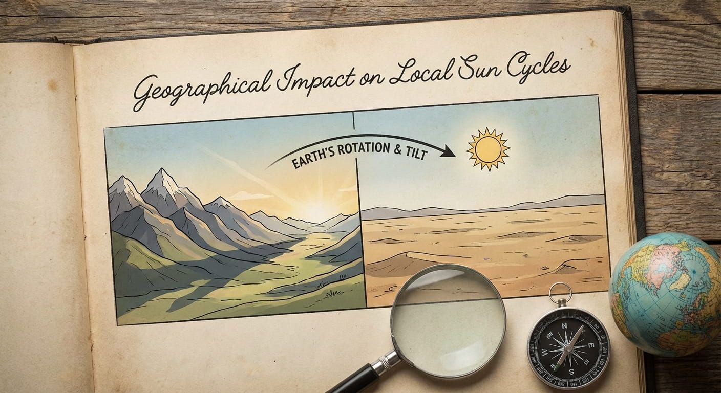
Altitude, sea level, and the hidden third coordinate
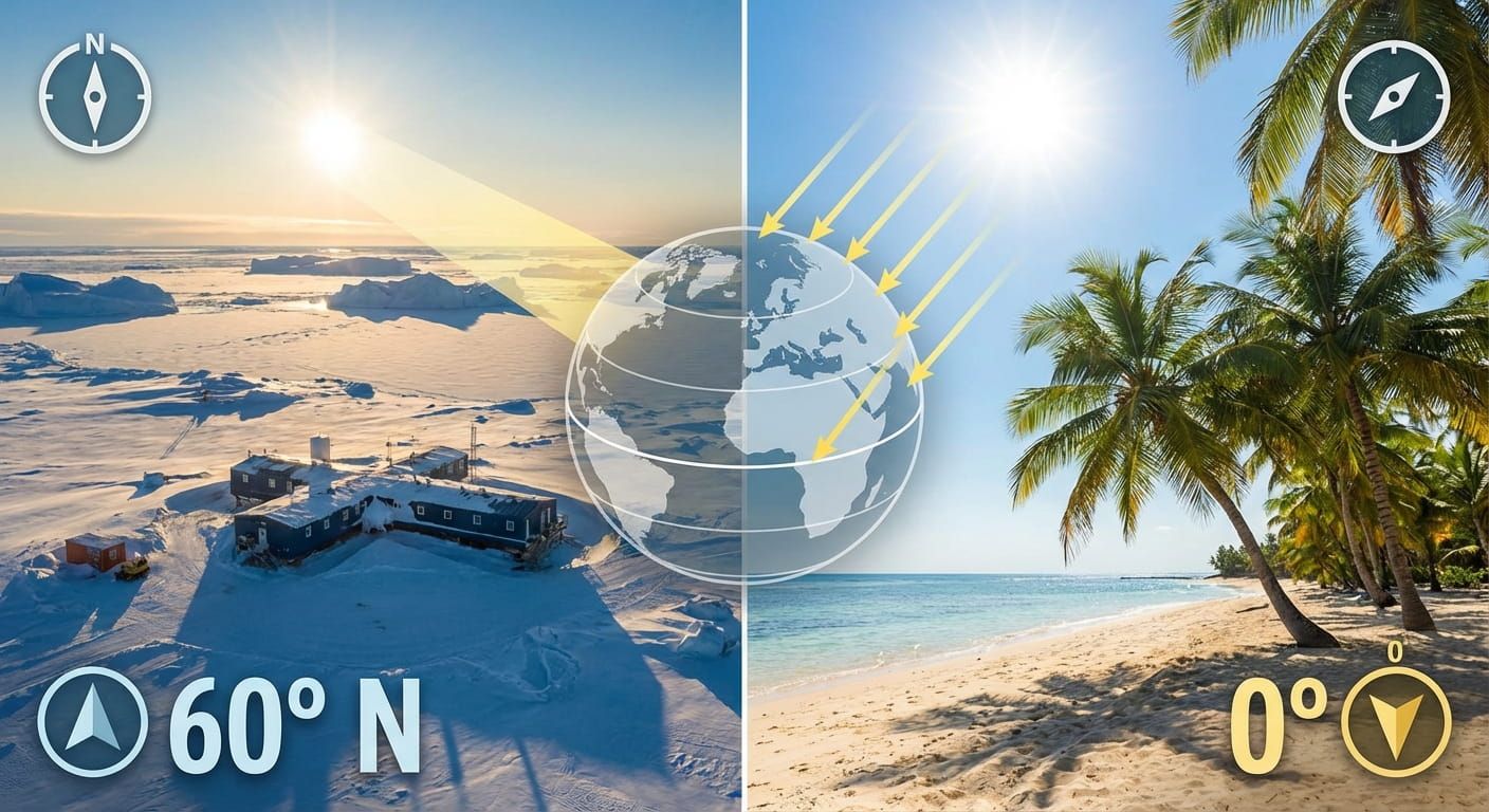
Latitude and longitude are a flat description of location on a globe. Real places have height. Altitude can affect sunrise times on mountain ridges, line of sight for radio and navigation, and local climate patterns. For many time use cases, altitude is not required. For local sun cycles, it can matter, especially at high latitudes where the sun skims low on the horizon.
If your goal is to connect coordinates to daylight and solar behavior, the discussion in geographical impact local sun cycles helps tie the geometry to what you actually see outside.
Coordinate work
From coordinates to time, how the connection is made
Time.you is built around exact time. Under the hood, exact time needs a solid reference clock, then a correct interpretation of where the user means. Atomic clock synchronization provides a stable backbone. Location data provides the mapping from a place to a time zone and local rules. Coordinates are the most universal input. If a page knows a point on Earth, it can select the correct time zone region, apply daylight rules where relevant, and display the current time for that spot.
For country pages, the mapping often feels straightforward. For larger countries, it gets complex fast. The United States spans multiple time zones. Australia spans multiple time zones. Russia spans many. That is why a coordinate based approach paired with local reference points is safer than guessing from a name alone. A reader checking time in United States might still need a city level or coordinate level interpretation to avoid mistakes near boundaries.
Time zones are political as much as geographic
Longitude hints at solar time, but legal time is set by governments. Borders, administrative regions, and historical decisions shape time zones. A town can sit at a similar longitude to another town yet keep a different legal time. That is not an error, it is policy.
If you want a deeper look at how borders and governance shape time, political geography national borders pairs well with coordinate concepts, because it explains why the same latitude and longitude logic does not always translate into the same clock time.
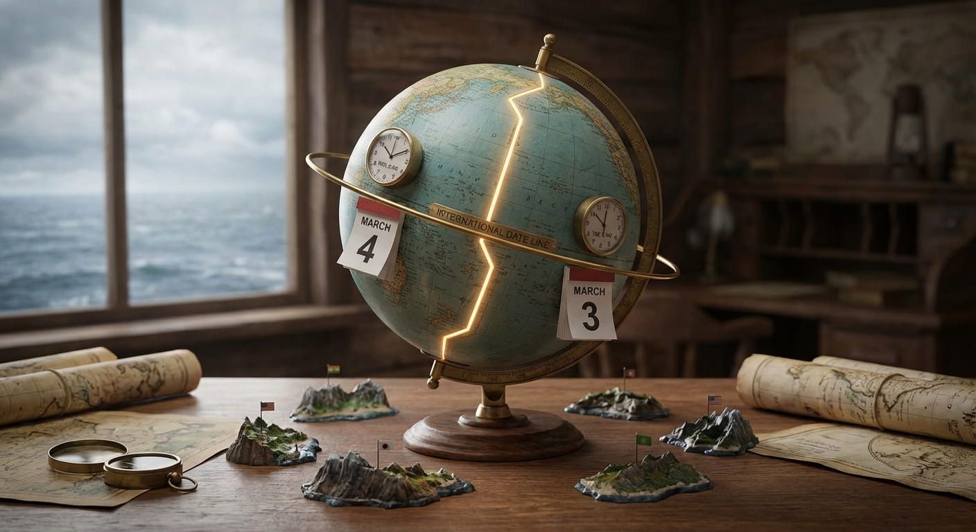
The international date line and why remote territories complicate everything
Any global time service has to handle date changes cleanly. The international date line is the rough dividing line where the calendar day flips. It is not a perfect straight line, because it bends to keep island groups and territories aligned with their chosen day. That bending is a human decision layered on top of geographic logic.
Remote islands are the classic test case. A short boat ride can cross an invisible rule boundary. The deeper context in international date line remote territories helps explain why a coordinate alone is not enough, you also need the rule set attached to that coordinate.
Local reference points that reduce errors in real workflows
Reference points are not just for travel talk. They help developers, researchers, and writers avoid confusion. Think of them as a label you can sanity check. If a dataset says a point is in Tokyo but the reference point says Osaka, someone made a mistake. If a point is supposed to represent Nairobi airport but the reference point is a downtown monument, the location might be too generic for aviation use.
These are examples of reference points that help many location pages stay accurate:
- Administrative center, city hall, regional capital, local district center
- Transport anchor, main station, harbor, airport
- Natural anchor, river confluence, bay, mountain pass, desert edge
- Community anchor, major hospital, university campus, market center
Numbered steps for validating a coordinate before publishing
- Check the hemisphere signs. Confirm north south and east west match the intended country.
- Plot the point on at least two maps. A mismatch often reveals a datum issue or a swapped pair.
- Add a local reference point. A nearby landmark creates a human verification path.
- Confirm the time zone region. Border areas can flip offsets even when the country name stays the same.
- Test the time output at the current moment. Compare to a trusted local source, then record that the page matches.
How Time.you pages benefit from region level context
Coordinates scale well, but readers also want structure. Region classifications help you browse, compare, and learn. A city hub connects to a country hub, which connects to larger geographic groupings. That organization also makes programmatic pages cleaner, because content can inherit the right context and terminology.
For broader browsing, the framing in global regions geographic classifications helps keep location content consistent without forcing everything into a single flat list of places.
Daylight patterns, sunrise logic, and why latitude matters for expectations
People often use time pages for planning, calling family, scheduling online events, tracking a live stream, or coordinating travel. Daylight adds another layer of expectation. In Singapore, the day length stays fairly steady. In Stockholm, it swings dramatically across the year. In Reykjavik, it can swing even more. That difference is driven by latitude, not by time zones.
If you want to connect time displays with daylight reality, regional daylight patterns fits well, because it focuses on how regions experience light differently even when clock time looks similar.
Using country and city examples to make coordinates feel real
Numbers stick better when you attach them to familiar places. Here are a few grounding examples you can picture without a map:
Singapore sits close to the equator, so latitude is small in magnitude, and daylight stays steady through the year. A country view like Singapore is a great example of how a compact place can still have rich local reference points, from coastal edges to dense neighborhoods.
Japan spans a longer north south range than many people expect, which changes sunrise behavior across the archipelago. Checking time for Japan becomes more meaningful when you remember that local reference points include islands and mountains as much as city centers.
India has huge geographic breadth and a single national time standard. Coordinates help you understand solar differences between western and eastern cities, even when the legal time stays unified. A broader view like India pairs nicely with coordinate thinking because it highlights the gap between solar noon and legal noon across the country.
Australia combines vast distances with multiple time zones and local policy choices. A country overview such as Australia is a reminder that one continent sized nation can hold several clock rules at once.
Common coordinate mistakes and how local reference points fix them
Most coordinate problems are boring, which is good news. They are predictable. They also show up repeatedly in datasets and content pipelines. Here are the classic ones, paired with the fix:
- Swapped latitude and longitude. Fix by verifying the local reference point against the plotted location.
- Wrong sign. Fix by checking hemisphere and comparing to the expected country and city.
- Mixed formats. Fix by converting degrees minutes seconds to decimal degrees before storage.
- Datum mismatch. Fix by tagging sources with the datum and converting before display.
- Generic city center used for everything. Fix by choosing a reference point that matches the page purpose, airport, port, downtown, or a known landmark.
How coordinates support programmatic pages without losing warmth
Programmatic location pages work best when they feel grounded. Coordinates supply the backbone, then reference points supply the voice. A reader should be able to glance at a place page and understand what the location represents, not only where it sits. That is where short plain explanations help, along with a single quote style box to break up the page.
A coordinate that matches the right landmark builds trust fast. Readers may not say it, but they feel it when a location is anchored to something real.
One compact checklist for writers and builders
These bullets work well as a final pass before publishing a location based page:
- Coordinate pair is in decimal degrees and matches the intended country
- Local reference point is specific and recognizable
- Time zone region derived from location matches expected local time
- Any daylight rule notes match the region and season
- Page language stays simple and avoids jargon where possible
Putting it to work inside the Geography and Locations hub
This topic belongs at the core of a geography hub because it connects browsing and computation. Browsing needs clear place names and reference points. Computation needs coordinates, time zones, and rule application. When those layers agree, a site can confidently show the current time for a major city, a smaller town, or a remote point, all with the same level of calm reliability.
Time.you already focuses on precise time across cities, countries, and time zones with atomic clock synchronized accuracy. Geographic coordinates and local reference points are the matching half of that promise. They are the bridge between a stable clock and a meaningful place.
Where a place becomes clear
A point on Earth can be written as two numbers. A place is more than that. A place has a name people use, a landmark they recognize, and a set of clock rules they live by. Coordinates give you the pin. Local reference points give you the story that keeps the pin honest. When both are present, global time becomes easier to trust, whether you are checking Mumbai, Tokyo, Sydney, Accra, Nairobi, or a quiet coastline far from any skyline.